About Lackawaxen Township
Text contributed by John McKay with the cooperation of Township Historians Helene Langhorst and Clarence James. With additional contributions from Jim Rementer and Pat Murphy.
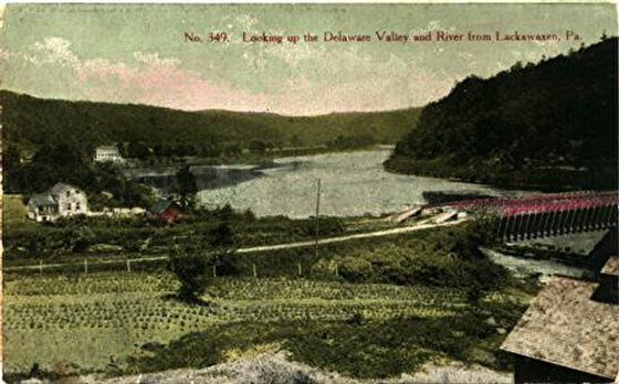
Lackawaxen is the largest and northernmost township in Pike County. It was designated Lackawaxen Township in 1798. Named for the river that flows 12 miles through the Township, Lackawaxen is believed to be the Indian word for “The Sandy Soil” or “The Sandy Place”. If it is pronounced a different way, it translates to “The Place Where Two Rivers Meet” and is the most likely the correct translation. The Delaware River marks the eastern boundary of the township and joins the Lackawaxen River at the village of Lackawaxen.
The area we now call St. Vincent’s Point and beyond into the Holbert property was used by the Lenape as a once-a-year trading post. Indians came from miles around with their goods to trade for things they needed that they couldn’t produce or procure in their own territories. Thus the name, “The Place Where Two Rivers Meet.”
Less than three centuries ago, the Leni-Lenape and Iroquois lived among the beetling rock outcrops and flatlands bordering the banks of these two rivers. Although the Indians never had any sizeable villages established in the region, it would appear that the rugged terrain provided a favorable hunting location for these earliest inhabitants. Numerous rock shelters and campsites have been verified by the presence of various Indian relics, including; tools, pot shards, and extensive bone fragments.
The first recorded presence of permanent settlers in the township were the homesteads of Jonathan Conkling and John Barnes. In 1770, they located near the confluence of the two rivers in what is today, the village of Lackawaxen. The presence of marauding Indians incited by the English during the Revolution made habitation by white settlers extremely perilous. An indication of the hazards of life in the Lackawaxen frontier is the Battle of Minisink in 1779. Directly across the Delaware from the village of Lackawaxen, approximately 45 settlers lost their lives to the superior forces of the English Colonel Joseph Brant (1742-1807) and his band of Indians and Tories.
During the early part of the 18th century, logging was the principal commercial activity in the township. Logs were fastened together and floated down the two rivers, eventually reaching their destination of Easton or Trenton. Because of the narrow channel of the Lackawaxen, smaller rafts, called “colts” were necessary to navigate the waters. It is estimated that during this period, 50 million board feet of lumber were taken down the Lackawaxen River annually.
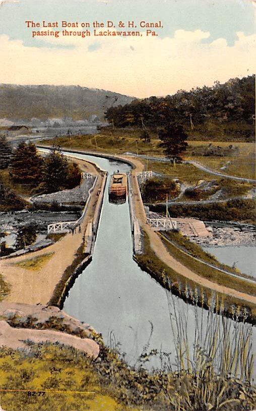
In 1827, the Delaware and Hudson Canal began operation between Honesdale, Pennsylvania (on the Lackawaxen River) and Kingston, New York (on the Hudson River). The canal company was the largest, private, commercial undertaking of the time. Originally, there were 28 locks in Lackawaxen Township which raised the elevation of the canal waters 278 feet. Along route 590 west of Lackawaxen, and along State Road 51018 west of Rowlands, many of the old locks are still visible and several lock houses are now used as private residences. These two roads follow the same route that the mules pulling canal barges used and together they are locally known as the “towpath”.
The canal linked New York City with the rich coal deposits of the Carbondale, Wilkes-Barre, and Scranton areas, and provided the fuel to feed the foundries and hearths of that burgeoning city.
Moreover, the canal sparked enterprise within the township. The Honorable George H. Rowland built a store in 1852 (at the present-day site of the Rowland’s Corner Store), cleared a farm, and engaged in the lumbering business. In 1861, Rowland was elected to the Pennsylvania State Legislature and served two terms. He won a seat in the State Senate in 1872, serving for 3 years, and filled a vacancy in 1885.
Roebling’s Delaware Aqueduct designated a National Historic Landmark in 1968 and a National Civil Engineering Landmark was constructed in 1848 as part of the Delaware and Hudson Canal. Designed by the future architect of the Brooklyn Bridge — John A. Roebling (June 12, 1806 – July 22, 1869).


